Chiusa
|
By Dion Protani
|
Latest update: 30 December 2023
|
|
The town of Chiusa (Klausen in German)is situated within the Province of Bolzano in the region of Trentino Alto Adige South Tyrol. It stands at an elevation of 523 metres and is included in the list of Borghi Più Belli d'Italia (most beautiful villages in Italy).
Chiusa is also an official comune that covers an area of 51 square kilometres and had a population of 5,178 on 1 January 2022. |
Related links
Chiusa or Klausen?
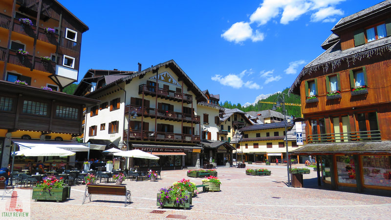
As is the case with much of the South Tyrol region, more than 90% of the population of the village regard German as their first language and consider themselves residents of Klausen rather than Chiusa. As such, the village does have a very Austrian feel to it, not only in the language you hear or see written on shop signs, but also with its cuisine and architecture.
This may cause a slight scratching of heads to modern-day visitors but is put into context when you consider South Tyrol was part of the Austro-Hungarian Empire right up until it was annexed by Italy in 1919. It was shortly after that date that a process of Italianisation took place with the renaming of places including rivers, towns and places of interest. A linguistic quirk of Chiusa is that it means "Closed" in Italian and therefore causes all sorts of problems when trying to find the village on Google!
This may cause a slight scratching of heads to modern-day visitors but is put into context when you consider South Tyrol was part of the Austro-Hungarian Empire right up until it was annexed by Italy in 1919. It was shortly after that date that a process of Italianisation took place with the renaming of places including rivers, towns and places of interest. A linguistic quirk of Chiusa is that it means "Closed" in Italian and therefore causes all sorts of problems when trying to find the village on Google!
Sightseeing Chiusa
Chiusa's centro storico (historic centre) occupies an area between the River Isarco (Tinnebach in German) to the south and the Sabiona Hill to the north which partially explains its "closed", as in "hemmed-in" name. Proudly sitting at the top of the hill is the Monastero di Sabiona which is enclosed by a crenellated wall embellished with a series of watchtowers. The land that traces up the hill from the village is lined with neat rows of vines creating the perfect backdrop for the historic centre below.
At the foot of the hill lies the Torre del Capitano (Burg Branzoll in German): a small fortress that's privately owned and not always open to visitors. The little castle lies just to the north of the village's main area of interest: Piazza Parrocchia. The main building on the Piazza is the Parrocchia di Sant'Andrea Apostolo church which dates back to the 15th century and from which the square takes its name.
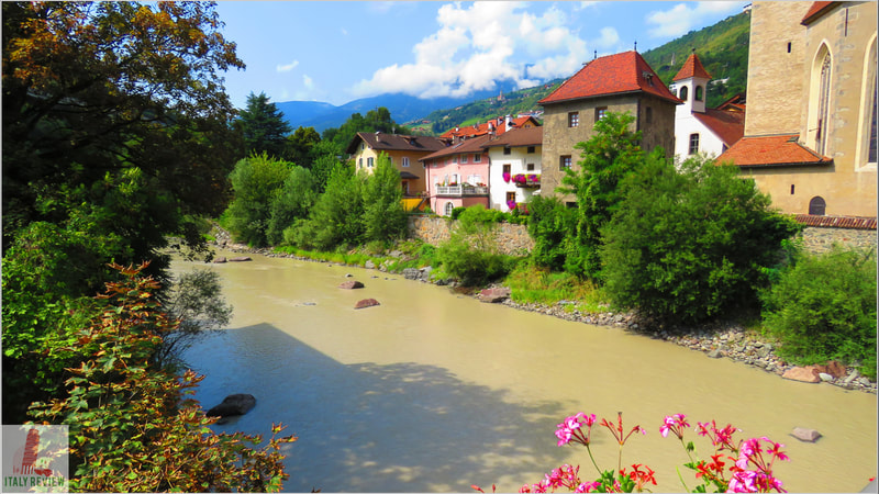
Equally as appealing however, are the colourful medieval buildings that make up the rest of the Piazza from which you can walk down to the river. If you cross the Ponte Sant'Andrea bridge to the other side, you can turn around and get some lovely photos and pick out the Monastery high up on the hill.
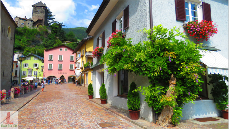
Leading north and south of Piazza Parrocchia is the village's main thoroughfare which divides into two different names at that point. To the north it's called Via Città Alta denoting the "Upper Town", and to the south it's called Via Città Bassa for the "Lower Town". This is a beautiful street lined with characteristic Tyrolean medieval buildings housing shops, restaurants and other businesses.
At the northern end of Via Città Alta is the village's main car park which works on a pay and display basis. From the car park it's just a 3 minute drive to the A22 motorway junction from which you can head north to Bressanone or south to Bolzano.
Comune di Chiusa
Gemeinde Klausen
|
Province: Bolzano
Region: Trentino Alto Adige South Tyrol Population: 5,218 (source: ISTAT 1 January 2023) Size: 51 km² Elevation: 523 metres Highlights: Ponte Sant'Andrea, Torre del Capitano, River Isarco Close by: Castelrotto, Bressanone, Ortisei, Siusi allo Sciliar Recommended accommodation: Cityhotel Goldener Adler B&B |
One of I Borghi più belli d'Italia (Italy's Most Beautiful Villages)
Listing headline: La Cittadina degli Artisti sull'Isarco (The Little Town of Artists on the Isarco River)
Listing headline: La Cittadina degli Artisti sull'Isarco (The Little Town of Artists on the Isarco River)

