Lama dei Peligni
|
By Dion Protani
|
Latest update: 26 November 2023
|
|
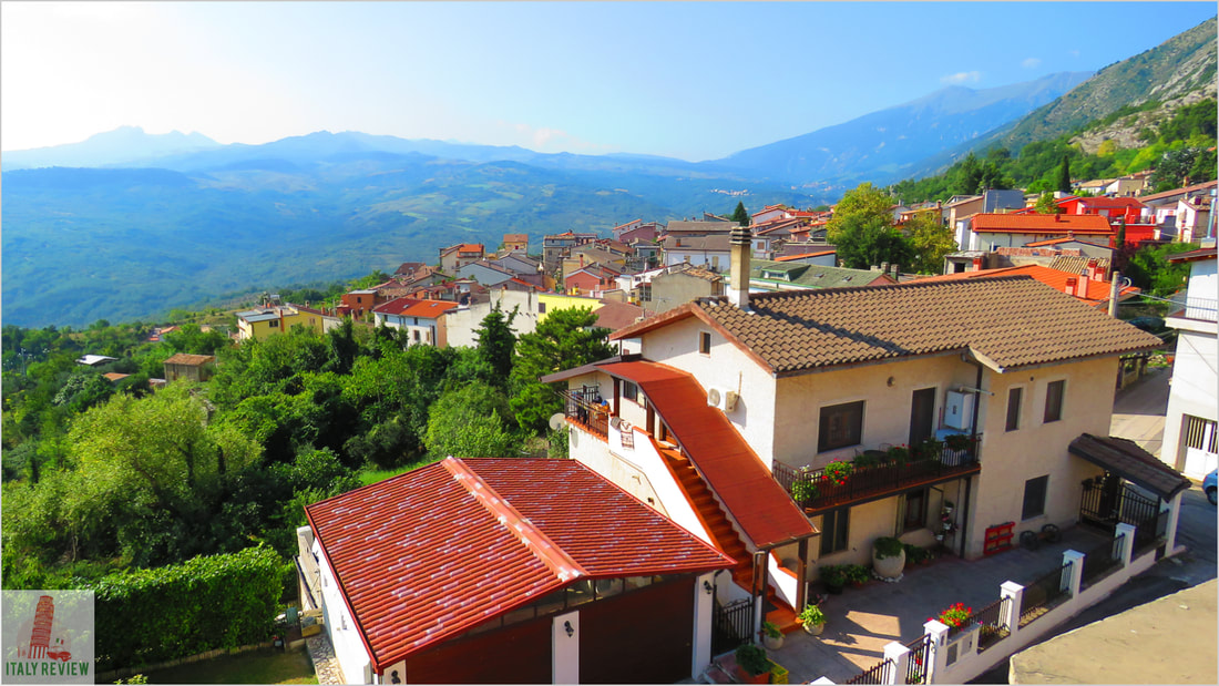
The town of Lama dei Peligni is situated within the Province of Chieti in the central region of Abruzzo. On 1 January 2022 it had a total population of 1,102 inhabitants. It stands at an elevation of 669 metres above sea level and covers 31 square kilometres.
Lama dei Peligni is located at the fringes of Abruzzo's Majella National Park and has an attractive but small historic centre. |
|
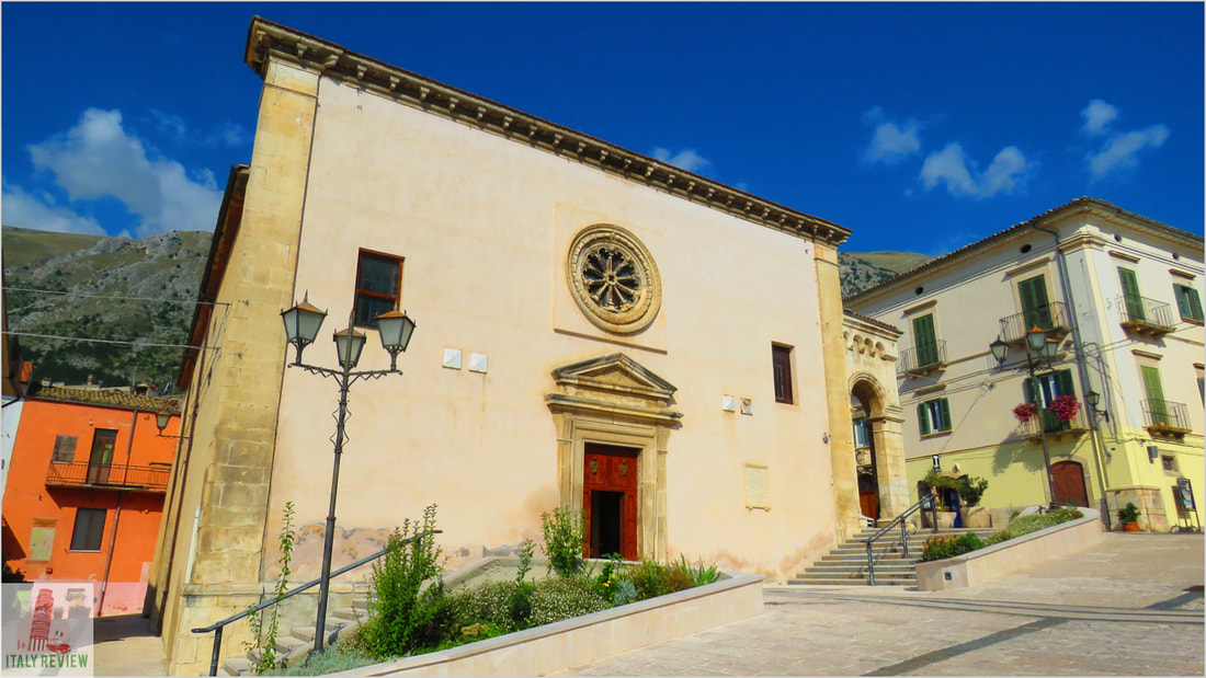
The main square in Lama dei Peligini is Piazza Umberto I which is also home to the pretty Chiesa dei Santi Nicola e Clemente. On the main road that leads into the town there's also a natural archaeological museum and botanical garden whose exhibits and specimens help to tell the story of the nearby Majella National Park.
Lama dei Peligni has been included in Touring Club Italia's list of Bandiera Arancione or Orange Flag towns since October 2016, one of half a dozen in Abruzzo to have earned the award.
Lama dei Peligni has been included in Touring Club Italia's list of Bandiera Arancione or Orange Flag towns since October 2016, one of half a dozen in Abruzzo to have earned the award.
Related links
Profile
Lama dei Peligni is a picturesque village located in the province of Chieti in the Abruzzo region of Italy. Tucked away in the Majella National Park, this charming village offers visitors a glimpse into traditional Italian life and a chance to immerse themselves in the beautiful natural surroundings.
History
The history of Lama dei Peligni dates back to ancient times, with evidence of human settlements found in the area since prehistoric times. The village has Roman origins and was an important center during the medieval period. Over the centuries, Lama dei Peligni has been influenced by various cultures, and its architecture and traditions reflect a rich historical heritage.
Highlights and nearby attractions
- Authentic Village Atmosphere: Lama dei Peligni is a small, authentic Italian village characterized by narrow cobblestone streets, historic stone buildings, and charming squares. The village's warm and welcoming atmosphere invites visitors to explore its hidden corners and interact with the friendly locals.
- Majella National Park: Lama dei Peligni is nestled within the stunning landscape of the Majella National Park, a protected area known for its rugged mountains, dense forests, and diverse wildlife. The park offers numerous hiking trails and opportunities for outdoor activities, making it a paradise for nature lovers and adventure enthusiasts.
- Religious Heritage: The village is home to several churches and religious sites of historical significance, such as the Church of San Michele Arcangelo and the Church of Santa Maria delle Grazie. These churches feature beautiful architecture and valuable religious artifacts.
- Festivals and Events: Throughout the year, Lama dei Peligni hosts various traditional festivals and events that celebrate local culture and customs. These festivals often include music, dance, food, and religious processions, providing visitors with a unique cultural experience.
- Local Cuisine: Visitors can savor the flavors of Abruzzo at local trattorias and restaurants, where traditional dishes like "arrosticini" (grilled lamb skewers) and "maccheroni alla chitarra" (homemade pasta) are served with locally sourced ingredients.
- Handicrafts: Lama dei Peligni is known for its handicrafts, especially traditional woven rugs and carpets. Visitors can explore workshops where skilled artisans create beautiful handmade pieces using age-old techniques.
- Rural Landscapes: The surrounding countryside is dotted with olive groves, vineyards, and fruit orchards, creating a picturesque rural landscape. The traditional agricultural practices add to the authenticity and charm of the area.
- Eco-Tourism: The Majella National Park and its proximity to other natural attractions make Lama dei Peligni an excellent destination for eco-tourism and outdoor activities, including hiking, cycling, and wildlife spotting.
- Relaxation and Tranquility: The village's peaceful atmosphere offers an escape from the hustle and bustle of city life, making it an ideal place for relaxation and rejuvenation.
Comune di Lama dei Peligni
|
Province: Chieti
Region: Abruzzo Population: 1,102 (source: ISTAT 1 January 2022) Size: 31 km² Elevation: 669 metres Highlights: Chiesa dei Santi Nicola e Clemente, Piazza Umberto Close by: Palena, Gessopalena, Torricella Peligna, Roccascalegna Recommended accommodation: Hotel Nido delle Rondine (30 km) |
Awarded the Bandiera Arancione (Orange Flag)
Listing date: 11th October 2015
1 of 6 in Abruzzo listed by Touring Club Italiano
Listing date: 11th October 2015
1 of 6 in Abruzzo listed by Touring Club Italiano