Turin Metro Map
|
By Dion Protani
|
Latest update: 30 December 2023
|
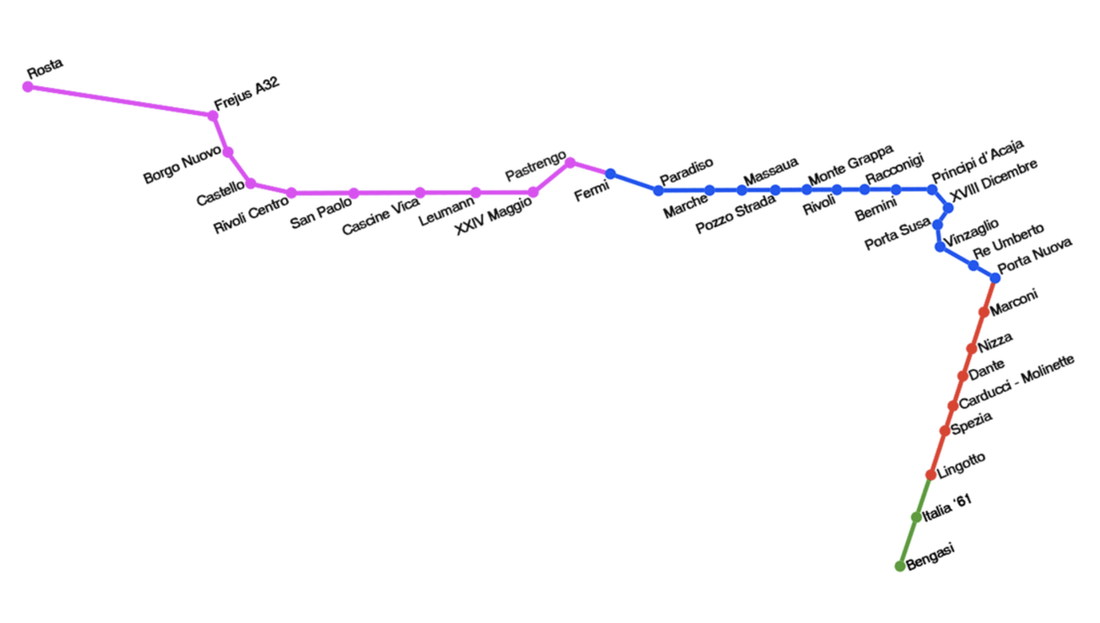
The Turin Metro Map is simple to understand because at present, it consists of just one line. The city's underground railway system is modern, clean and efficient, although its usefulness in terms of sightseeing is limited. It covers an area to the west and to the south of the city centre with the main station of interest being Porta Nuova.
This is the stop of Turin's Porta Nuova Train Station from where you can take overland trains to other parts of Italy. Porta Nuova is just about the closest you get to the city centre with the Metro system and from here it's best to access the major sights on foot. Piazza Castello with its sights such as Palazzo Madama and the Royal Palace of Turin is one kilometre from Porta Nuova, a fifteen minute walk.
This is the stop of Turin's Porta Nuova Train Station from where you can take overland trains to other parts of Italy. Porta Nuova is just about the closest you get to the city centre with the Metro system and from here it's best to access the major sights on foot. Piazza Castello with its sights such as Palazzo Madama and the Royal Palace of Turin is one kilometre from Porta Nuova, a fifteen minute walk.
Related links
Metropolitana di Torino
|
City: Turin
Province: Metropolitan City of Turin Region: Piedmont Opened: 2006 Lines: 1 Recommended accommodation: Turin Palace Hotel |

